
New Zealand maps from Omnimap, the leading international map store with 250,000 map titles.
Mục Lục
New Zealand Road Atlases, Travel and City Maps
New Zealand Atlases
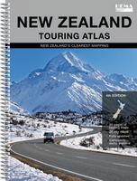
New Zealand Road Atlas. Variable. Hema. This road atlas includes 23 new maps, maps of all of the National Parks and the Te Araroa Trail, 80 pages of touring maps, 47 city and suburb maps, over 1100 motorhome parks and campsites, and much more. Fully indexed.
 Sample from the road maps
Sample from the city maps
 $39.9965-0788New Zealand Atlas.
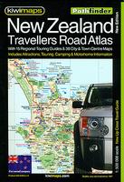
New Zealand Road Atlas. 1:500,000. Kiwi. A detailed spiral-bound road atlas with enlargements for environs of the main cities, street plans of town centers, an index of localities, roads/tracks and streets, plus information driving regulations.
Sample from the road atlas
$39.9965-0788TAtlas.

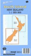
New Zealand North and South Island Road Atlases. 1:250,000. Kiwimap. Detailed spiral-bound road atlases of the North and South Islands of New Zealand. The main mapping is at 1:250,000 with very detailed presentation of the road network from motorways to 4WD tracks. Railway lines, ferry routes, local airfields and airstrips are marked. National Parks and protected areas are highlighted, and symbols mark places of interest, a very wide range of sport and recreational facilities, wine growing regions, hot springs and thermal areas, campsites and motorhome/caravan parks, etc. Selected walking tracks are also shown including the New Zealand Walkway and the Te Araroa Walkway. Topography is shown by relief shading, spot heights and names of various mountain ranges. Unfortunately no geographical coordinates are provided. More detailed mapping at scales of 1:150,000 to 1:175,000 cover the main metropolitan areas of New Zealand.
The detailed index for each atlas has separate lists of cities/towns/localities, rural roads/tourist routes/4WD tracks/forestry road, streets for each of the plans, and rural features (mountain and passes, coastal and water features, forests/parks/conservation areas, campsites and caravan parks, dump stations, recreational area, etc). The atlas also includes lists of visitor centers, a section on road safety and traffic signs, and a distance table.
Sample from the South Island Road Atlas
$49.9965-07881NSouth Island Road Atlas.
$49.9965-07881SSouth Island Road Atlas.
New Zealand Wall Map
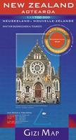
New Zealand Geographic Wall Map. 1:1,700,000. Gizimap. Slightly smaller wall map than the Hema map above. This wall map of New Zealand is designed to provide a good overview of the country’s topography. The map shows elevation by color-shading and spot heights It has names of various mountain ranges and selected peaks and national parks and protected areas are clearly marked.
The road network includes selected rural roads and shows intermediate distances on main routes. Railways, airports and main ferry connections are marked and the map also shows local internal administrative divisions with names of the provinces.
Symbols highlight tourist sites and services, including beaches, diving and windsurfing sites, skiing areas, caves, campsites, etc. The map has a latitude and longitude grid at 1° intervals. Map legend includes English. The index is on the reverse side.
Also included are separate distance tables for the North and South islands, a small administrative map of the country and a map of South-western Pacific. Size is 73 x 94 cm.
Image of the entire New Zealand wall map.
$27.9965-07908R1 sheet, flat/rolled.
$36.9965-07908LLaminated.
New Zealand Travel Maps
New Zealand Geographic Travel Map. 1:1,700,000. Gizimap.
Slightly smaller wall map than the Hema map above. This map is designed to provide a good overview of the country’s topography. The map shows elevation by color-shading and spot heights. It has names of various mountain ranges and selected peaks and national parks and protected areas are clearly marked.
The road network includes selected rural roads and shows intermediate distances on main routes. Railways, airports and main ferry connections are marked and the map also shows local internal administrative divisions with names of the provinces.
Symbols highlight tourist sites and services, including beaches, diving and windsurfing sites, skiing areas, caves, campsites, etc. The map has a latitude and longitude grid at 1° intervals. Map legend includes English. The index is on the reverse side.
There are distance tables for the North and South islands, a small administrative map of the country and a map of South-western Pacific. Size is 73 x 94 cm.
Sample detail of the New Zealand road map.
$14.9965-079081 sheet, folded.
$27.9965-07908R1 sheet, flat/rolled.
$36.9965-07908LLaminated.
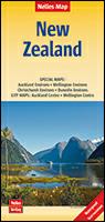
New Zealand Travel Map. 1:1,250,000. Nelles Verlag.
A good road map of New Zeland with the road network overlain on a shaded relief / physical base map. Multilingual legend.
$13.9565-07901 sheet, folded.
New Zealand Regional Road Map Series
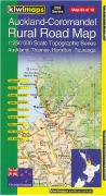
New Zealand 1:250,000 Rural Road Quadrangle Maps. 1:250,000. Kiwimaps. This new map series makes excellent touring maps of New Zealand. The maps have shaded relief to show elevation, numerous spot heights, liberal use of symbols to show tourist sites and services, scenic routes, and more. Each map is extensively indexed with named rural roads.
 Sample from the Auckland map sheet.
 Index map shows the sheet layout.
 $16.9965-0752K-01Far North. Sheet 1.
$16.9965-0752K-02Northland. Sheet 2.
$16.9965-0752K-03Auckland – Coromandel. Sheet 3.
$16.9965-0752K-04Waikato – Bay of Plenty. Sheet 4. 1987.
$16.9965-0752K-05East Cape. Sheet 5.
$16.9965-0752K-06Taranaki – Ruapehu. Sheet 6.
$16.9965-0752K-07Hawke’s Bay. Sheet 7.
$16.9965-0752K-08Wellington – Wairarapa. Sheet 8.
$16.9965-0752K-09Nelson – Marlborough. Sheet 9.
$16.9965-0752K-10North Westland. Sheet 10.
$16.9965-0752K-11Marlborough – Kaikoura. Sheet 11.
$16.9965-0752K-12South Westland. Sheet 12.
$16.9965-0752K-13Canterbury. Sheet 13.
$16.9965-0752K-14Southern Lakes. Sheet 14.
$16.9965-0752K-15Otago – Southern Canterbury. Sheet 15.
$16.9965-0752K-16Fiordland. Sheet 16.
$16.9965-0752K-17Otago – Southland. Sheet 17.
$16.9965-0752K-18Stewart Island. Sheet 18.
$215.1065-0753KSet of 18 sheets
New Zealand City Maps. 1:30,000 & larger-scale inset maps. Kiwimaps. This popular NZ-based map publisher offers a good selection of street maps and atlases for New Zealand cities. The ones below are currently in stock – other maps are coming.
Sample of the map detail from the Dunedin map.
Sample of the map detail from the New Plymouth map.
$8.9565-0792NONorth Shore Auckland. 2007.
$12.9965-0792AUAuckland. 2008. Includes large-scale Inner City map.
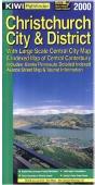
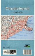
$11.9565-0792CHChristchurch. 2008. Includes Ashburton, Rangiora & 19 Canterbury Towns.
$8.9565-0792COCoromandel. 2008. Includes Franklin District & 51 town maps.
$12.9965-0792DUDunedin, Mosgiel, Oamaru, & 12 Otago Towns. 2008.
$8.9565-0792GIGisborne. Includes 20 Eastland towns.
$8.9565-0792HAHamilton City. Includes Cambridge, Te Awamutu, Kihikihi, Ngaruawahia, and Huntly.
$8.9565-0792INInvercargill, Stewart Island, & 22 Southland Towns. 2007.
$8.9565-0792MAMasterton. Includes 13 Wairarapa town maps.
$8.9565-0792NANapier, Hastings, & 12 Hawke’s Bay Towns. 2008.
$12.9965-0792NENelson. Includes Blenheim, Picton, and 17 town maps.
$8.9565-0792NFNew Plymouth. 2008. Includes 23 Taranaki town maps.
$8.9565-0792OROrewa, Warkworth, Whangaparaoa. 2007.
$8.9565-0792QUQueenstown. Includes 14 southern provincial town maps.
$12.9965-0792RORotorua, Whakatane, & 12 Central Bay of Plenty Towns. 2007.
$8.9565-0792PAPalmerston North, Levin, Feilding, & 19 Towns. 2007.
$8.9565-0792TAUTaupo. Includes Tokorao, Turangi, and 19 town maps.
$12.9965-0792TBTauranga, Mt. Maunganui & 10 Provincial Bay of Plenty towns. 2008.
$8.9565-0792TITimaru, Ashburton, & 19 South Canterbury towns. 2008.
$8.9565-0792WAWanganui, Marton, & Taihape. 2007.
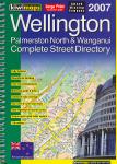
$12.9965-0792WEWellington. Includes a large-scale central city map and maps of the Kapiti Coast and Levin.
$8.9565-0792WFWest Coast. Includes Greymouth, Hokitika, Westport, and Reefton.
$8.9565-0792WHWhangarei, Bay of Islands. 2007.
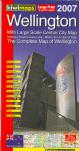
Wellington City Street Map. 1:35,000 & detailed city-center maps. Kiwimap. Includes main routes, scenic routes, state highways, parks, schools, fully indexed.
$9.9565-0775T1 sheet, folded.
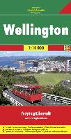
Wellington City Street Map. 1:10,000. Freytag + Berndt. Includes public transportation routes and a street indexe. Map size is 94 x 125 cm.
$12.9965-0792WT1 sheet, folded.
Wellington City Street Atlas. 1:11,000 & 1:25,000 & 1:275,000. Kiwimap. Detailed spiral-bound street atlas of Wellington and surrounding area. Includes neighborhood-center inset maps, tourist routes, motorway guide, educational facilities, fully indexed, etc.
New Zealand Topographic and Physical Maps
New Zealand is quite well mapped and complete coverage is available at both 1:250,000 and 1:50,000 (which replaced the older 1:63,360 series). In addition to these topographic series, DOSLI produces a wide range of tourist-oriented maps; 1 to four-sheet physical and topographic maps that make excellent road maps; and city plans.
New Zealand Topographic Quadrangle Maps. 1:50,000. New Zealand Department of Survey and Land Information. Complete coverage is now available for New Zealand. We stock partial coverage – delivery time on the other sheets is about 2 weeks.
Index map for the North Island.
Index map for the South Island.
Sample detail from the New Zealand 1:50,000 map series
Sample detail from the New Zealand 1:50,000 map series
Itemized listings – Click here to order individual quadrangles. Note that this is the listing for the old series – we will ship the corresponding New Series map. I hope to have the listing of the New Series sheets on-line in the next two weeks.
$17.9565-0750Specify sheet number at check-out.
New Zealand 1:250,000 Topographic Quadrangle Maps. 1:250,000. New Zealand Department of Survey and Land Information. Relief shading and contours, at 100m intervals, are used to show the terrain on these clear maps. Very good road and settlement detail, with everything from state highways to foot tracks and major cities to hut settlements shown. Other features include radio, TV and microwave masts, major power lines, airports and aerodromes, lighthouses, stopbanks. Various natural features, such as mangroves, swamps, native and exotic forests are also marked. Each map covers an area 150km by 200km. Grid squares at 10km interval and latitude and longitude margin ticks at 1′ intervals. Uses the New Zealand grid.
Index map for the North Island (1 meg).
Index map for the South Island (1 meg).
$17.9565-0752-01Sheet 1 – North Cape topographic map. 
$17.9565-0752-02Sheet 2 – Kaikohe topographic map.
$17.9565-0752-03Sheet 3 – Warkworth topographic map.
$17.9565-0752-04Sheet 4 – Dargarville topographic map.
$17.9565-0752-05Sheet 5 – Auckland topographic map.
$17.9565-0752-06Sheet 6 – Tauranga topographic map.
$17.9565-0752-07Sheet 7 – East Cape topographic map.
$17.9565-0752-08Sheet 8 – New Plymouth topographic map.
$17.9565-0752-09Sheet 9 – Taumarunul topographic map.
$17.9565-0752-10Sheet 10 – Napler topographic map.
$17.9565-0752-11Sheet 11 – Gisborne topographic map.
$17.9565-0752-12Sheet 12 – Takaka topographic map.
$17.9565-0752-13Sheet 13 – Nelson topographic map.
$17.9565-0752-14Sheet 14 – Palmerston North topographic map.
$17.9565-0752-15Sheet 15 – Dannevirke topographic map.
$17.9565-0752-16Sheet 16 – Wellington topographic map.
$17.9565-0752-16Sheet 17 – Greymouth topographic map.
$17.9565-0752-17Sheet 18 – Murchison topographic map.
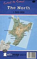
New Zealand Topographic Maps (Coast-to-Coast series). 1:500,000. New Zealand Department of Survey and Land Information. A series of four maps covering both islands of New Zealand. Beautifully coloured with relief shading of the terrain and spot heights. Main highways are clearly shown and numbered. Forests, swamps, mangroves, airports, towns and cities are among the features marked. Latitude and longitude grid squares at 1° intervals with ticks at 1′ intervals.
New Zealand Coast-to-Coast Series 1:500,000
Sample from sheet 2
Sample #2
$16.9565-0754-1Further North sheet. 1989.
$16.9565-0754-2North sheet. 1995.
$16.9565-0754-3North Meets South sheet. 1995.
$16.9565-0754-4South sheet. 1989.
New Zealand Topographic Map. 1:1,000,000. New Zealand Department of Survey and Land Information (#265). 1989. Beautifully coloured with relief shading of the terrain and spot heights. Main highways are clearly shown and numbered. Forests, swamps, mangroves, airports, towns and cities are among the features marked. Latitude and longitude grid squares at 1° intervals with ticks at 1′ intervals.
$12.9965-07545NNorth Island (265-1)
$12.9965-07545SSouth Island (265-2)
$23.4065-075452 sheets, folded
New Zealand National Park, Tourist Area, and Island Protectorate Maps
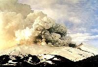
Mt. Ruapehu Eruption poster. Craig Potten, NZ. This superb photo shows a large ash eruption of Mt. Ruapehu, located in Tongariro National Park. This 2,797 meter (9,176 ft.) is New Zealand’s largest active volcano.
$12.9565-0784-RU1 sheet, rolled.
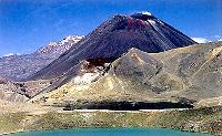
Tongariro National Park poster. Craig Potten, NZ. This spectacular photo shows the volcanoes for which Tongariro is famous. In the foreground is a small lake, colored a wonderful blue, with volcano cones in the background. Printed on glossy photo paper, size is 23 x 17½”.
$12.9565-0784-TO1 sheet, rolled.
New Zealand Topographic Hiking Maps. NewTopo, New Zealand. These maps are designed to encourage hiking in three of the most popular hiking areas of New Zealand. Easy to read, showing essential topographic information without clutter. A realistic landform provides a useful geographic context. The road network is very detailed and yet is clear and easy to follow. Car parks are shown at track entry points.
 Sample of the map detail.
Sample of the map detail.
Sample of the map detail.
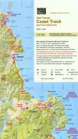
$13.9965-0773-ALPAbel Tasman Coast Track hiking map. 1:65,000. 2008.
$13.9965-0773-AOTAotea Great Barrier Reef hiking map. 1:90,000. 2008.
$13.9965-0773-AUNAuckland Walks: North hiking map. 1:75,000. 2007.
$13.9965-0773-AUSAuckland Walks: South hiking map. 1:75,000. 2007.
$13.9965-0773-BANBanks Peninsula hiking map. 1:60,000. 2009.
$13.9965-0773-DUNDunedin Walks – Silver Peaks to Taiaroa Head hiking map. 1:75,000. 2009.
$13.9965-0773-QUEQueen Charlotte Track, Marlborough Sound, hiking map. 1:75,000. 2008.
$13.9965-0773-RANRangitoto and Waiheke Islands hiking map. 1:42,000. 2007.
$13.9965-0773-ROURouteburn Track, Mt. Aspiring and Fiordland National Parks hiking map. 1:50,000. 2008.
$13.9965-0773-RUARuapehu Round the Mountain Track, Tongariro N.P. hiking map. 1:60,000. 2009.
$13.9965-0773-TARTararua Tramps hiking map. 1:75,000. 2005.
$13.9965-0773-TONTongariro N.P. hiking map. 1:60,000. 2009.
$13.9965-0773-ALPTongariro Alpine Crossing hiking map. 1:40,000. 2008.
$13.9965-0773-WELWellington Walks hiking map. 1:75,000. 2005.
New Zealand National Park Topographic Maps. New Zealand Department of Survey and Land Information. This includes New Zealand’s Trackmap and Parkmaps series. These maps illustrate the spectacular scenery of New Zealand’s mountains and rocky coastal shores. Each map has full topographic detail, hiking trails, and other tourist information.
New Zealand National Park Maps
New Zealand Parks and Tracks
$16.9965-0774BAbel Tasman park map. 1:50,000. #273/7. 2006.
$16.9965-0774COCoromandel park map. 1:150,000. 336/11. 2006.
$14.9565-0774FEgmont park map. 1:50,000. 273/9. 1994.
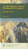
$14.9565-0774HFiordland park map. 1:250,000. 273/3. 2004.
$14.9565-0774KCKaweka park map. 1:100,000. 274/12. 1990.
$16.9965-0774KEKepler Track park map. 1:50,000. 335/9. 2003.
$16.9965-0774MMilford Track park map. 1:75,000. 335/1. 2003.
$16.9965-0774NNelson Lakes park map. 1:100,000. 273/5. 2011.
$14.9565-0774NPPaparoa park map. 1:50,000. 273/12. 1990.
$16.9965-0774RORouteburn and Greenstone Tracks park map. 1:75,000. #335/2. 2004.
$14.9565-0774STSt. James & Lewis Pass park map. 1:50,000. 335/06.
$14.9565-0774TATararua park map. 1:100,000. 274/2. 1988.
$14.9565-0774RUrewera park map. 1:130,000. 273/8. 1993.
New Zealand Island Possessions Topographic Maps. New Zealand Department of Survey and Land Information. These maps cover some of New Zealand’s protectorate islands in the South Pacific Ocean.
New Zealand Aotearoa (189K)
$15.9565-0772BAntipodes map. 1:25,000. 1978.
$15.9565-0772DAuckland map. 1:50,000. 1991.
$15.9565-0772SSnares Island & Bounty Island map. 1:25,000. 1981.
$17.9565-0772WWaiheke Island map. 1:50,000. #336/3. 1989.
New Zealand Geologic and Thematic Maps
Free-Air Gravity Field of the New Zealand Region. 1:3,000,000. Geol. Soc. America (MC-48). 1983. Covers New Zealand, the Kermadec Trench, and the surrounding region. With 8-page text.
$6.9565-0712Each, folded
Geological Resource Map or Chatham Island. 1:50,000. Institute of Geological and Nuclear Sciences. #QM405. With separate text booklet.
Geophysical Maps
Southern Oceans gravity anomaly, New Zealand region. 1:4,000,000. Institute of Geological and Nuclear Sciences. 1996.
$89.9565-0716-011 set, folded
New Zealand Soils Map. 1:253,440. 1954-1969. NZ DSIR. This set of 21 sheets covers the North and South Islands. A 690-page text accompanies the maps.
$99.9565-0735ANorth Island
$99.9565-0735BSouth Island
1:250,000 Geological Map of New Zealand (old series). 1:250,000. Institute of Geological and Nuclear Sciences. This is the older series being replaced by the new series noted above. Please note that the sheet numbers do not correspond between the two series. Please look at the index map for each series to choose the appropriate map.
Index for 1st series.
$19.9565-0758-02ASheet 2A. Whangarei. 1961.
$19.9565-0758-07Sheet 7. Taranaki. 1967, reprinted 1975.
$19.9565-0758-16Sheet 16. Kaikoura. 1963, reprinted 1975.
$19.9565-0758-17Sheet 17. Hokitika. 1967, reprinted 1975.
$19.9565-0758-18Sheet 18. Hurunui. 1964, reprinted 1975.
$19.9565-0758-19Sheet 19. Haast. 1965, reprinted 1975.
$19.9565-0758-20Sheet 20. Mt. Cook. 1968, reprinted 1975.
$19.9565-0758-21Sheet 21. Christchurch. 1973.
$19.9565-0758-27Sheet 27. Fiord. 1960.
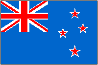 New Zealand Flags
$3.9967-1070NEWNew Zealand flag, small. Size 4 x 6 in.
$9.9567-1071NEWNew Zealand flag, medium. Size 8 x 12 in.
$49.9567-1073NEWNew Zealand flag, large. Size 2 x 3 ft.
![]()


![Toni Kroos là ai? [ sự thật về tiểu sử đầy đủ Toni Kroos ]](https://evbn.org/wp-content/uploads/New-Project-6635-1671934592.jpg)