
São Tomé – Wikipedia
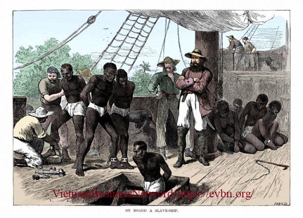
History
Edit
Geography
Edit
Population history
EditHistorical populationYearPop.±% 1990
(June 23, Census) 42,331— 2000
(June 16, Census) 49,957+18.0% 2003
(Estimate) 53,300+6.7% 2018
(July 1, Estimate) 71,868+34.8%
Transport
Edit
São Tomé is served by São Tomé International Airport (IATA: TMS, ICAO: FPST) with regular flights to Europe and other African Countries.
Climate
Edit
São Tomé features a tropical wet and dry climate (Köppen As), although it is not far above a semi-arid climate (BSh) due to the influence of the cold Benguela Current, which makes even the wettest months drier than would be expected for such a low latitude but at the same time makes the city very cloudy and foggy even during the almost rainless dry season mid-year. The city has a relatively lengthy wet season from October through May and a short dry season. São Tomé sees on average just under 900 mm (35 in) of rainfall per year. Temperatures in the city are relatively constant, with average high temperatures usually around 30 °C (86 °F) and average low temperatures around 22 °C (71.6 °F).
Climate data for São Tomé (São Tomé International Airport)
Month
Jan
Feb
Mar
Apr
May
Jun
Jul
Aug
Sep
Oct
Nov
Dec
Year
Record high °C (°F)
32.0
(89.6)
33.6
(92.5)
33.5
(92.3)
33.4
(92.1)
33.9
(93.0)
31.0
(87.8)
30.7
(87.3)
31.0
(87.8)
31.7
(89.1)
31.5
(88.7)
31.6
(88.9)
32.0
(89.6)
33.9
(93.0)
Average high °C (°F)
29.4
(84.9)
29.9
(85.8)
30.2
(86.4)
30.1
(86.2)
29.3
(84.7)
28.0
(82.4)
27.3
(81.1)
27.7
(81.9)
28.6
(83.5)
28.7
(83.7)
29.0
(84.2)
29.1
(84.4)
28.9
(84.0)
Daily mean °C (°F)
25.9
(78.6)
26.2
(79.2)
26.4
(79.5)
26.4
(79.5)
26.0
(78.8)
24.7
(76.5)
23.8
(74.8)
24.1
(75.4)
25.0
(77.0)
25.2
(77.4)
25.5
(77.9)
25.6
(78.1)
25.4
(77.7)
Average low °C (°F)
22.4
(72.3)
22.5
(72.5)
22.6
(72.7)
22.6
(72.7)
22.6
(72.7)
21.4
(70.5)
20.4
(68.7)
20.5
(68.9)
21.3
(70.3)
21.8
(71.2)
22.0
(71.6)
22.1
(71.8)
21.8
(71.2)
Record low °C (°F)
19.1
(66.4)
19.6
(67.3)
19.2
(66.6)
19.4
(66.9)
18.5
(65.3)
14.0
(57.2)
14.0
(57.2)
13.4
(56.1)
16.0
(60.8)
18.3
(64.9)
18.8
(65.8)
19.6
(67.3)
13.4
(56.1)
Average rainfall mm (inches)
81
(3.2)
84
(3.3)
131
(5.2)
122
(4.8)
113
(4.4)
19
(0.7)
0
(0)
1
(0.0)
17
(0.7)
110
(4.3)
99
(3.9)
108
(4.3)
885
(34.8)
Average rainy days
(≥ 0.1 mm)
8
8
12
11
10
3
2
3
6
12
11
8
94
Average relative humidity (%)
85
84
83
83
84
79
77
78
79
82
85
85
82
Mean monthly sunshine hours
142.6
135.6
139.5
126.0
145.7
165.0
161.2
148.8
120.0
114.7
135.0
142.6
1,676.7
Mean daily sunshine hours
4.6
4.8
4.5
4.2
4.7
5.5
5.2
4.8
4.0
3.7
4.5
4.6
4.6
Source: Deutscher Wetterdienst[8]
Education
Edit
Health
Edit
The main hospital of the country is Hospital Ayres de Menezes.
Sports
Edit
Sports clubs based in the city include Sporting Praia Cruz and Vitória FC based in the neighborhood of Riboque. All clubs play at Estádio Nacional 12 de Julho.
Places of worship
Edit
Gallery
Edit
Notable people
Edit
International relations
Edit
References
Edit


![Toni Kroos là ai? [ sự thật về tiểu sử đầy đủ Toni Kroos ]](https://evbn.org/wp-content/uploads/New-Project-6635-1671934592.jpg)